Documenting the file format
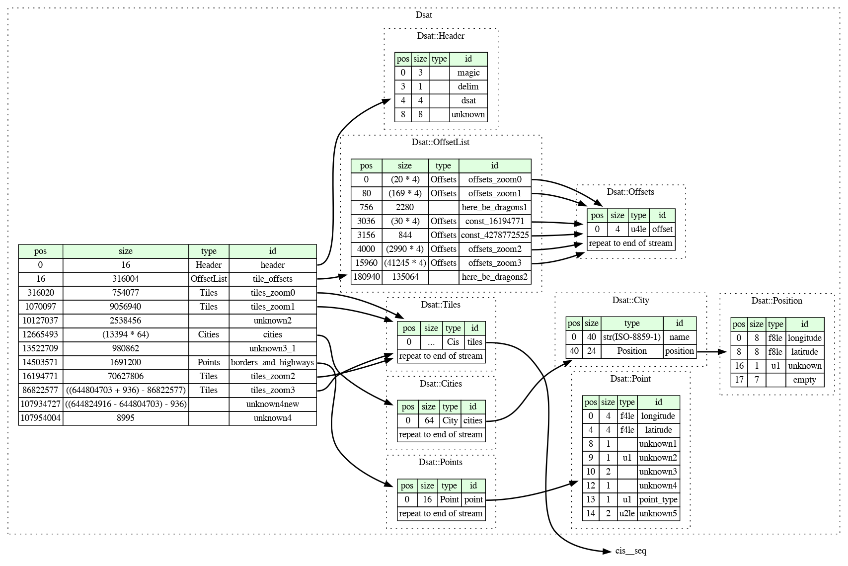
Since the first post on decoding the city database I have learned so much more about the structure of the D-Sat file format: where the image tiles are located, how they are indexed and which information the image header reveals, as well as that the file also contains points describing borders and highways.
It is time to document this knowledge. With Kaitai Struct I found a solution for that: I can describe the file format in a simple YAML file, automatically generate code to parse files, and also visualize the structure:
The image format of the tiles is described in a separate file and so far only details some header fields:
