Solving a mystery (and finding something unexpected again)
We have now mapped almost all parts of dsatnord.mp except for the
one I have dubbed
unknown2. Looking
at the greyscale byte representation again, we can see roughly five
regions with distinct patterns:

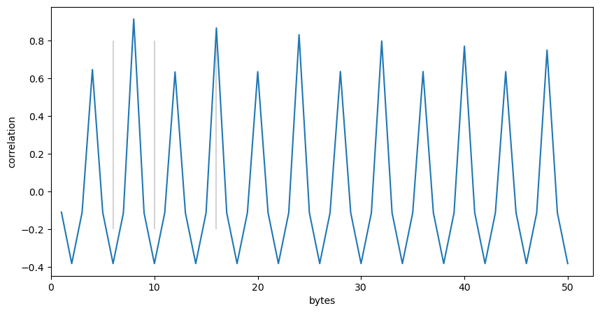
With Gimp I identified the numbers of the rows of the image that roughly divide the parts: 553, 1050, 1508, and 1574. I then started to analyse the different parts using auto-correlation to find the byte size of (potential) records. For the first part from row 0 to row 553 I found a high correlation for a record size of 8 bytes:
With the experience I have gained analysing the previous parts, I extracted two 32 bit values from each record and quickly found that they yield the following scatter plot when they are interpreted as unsigned integers:
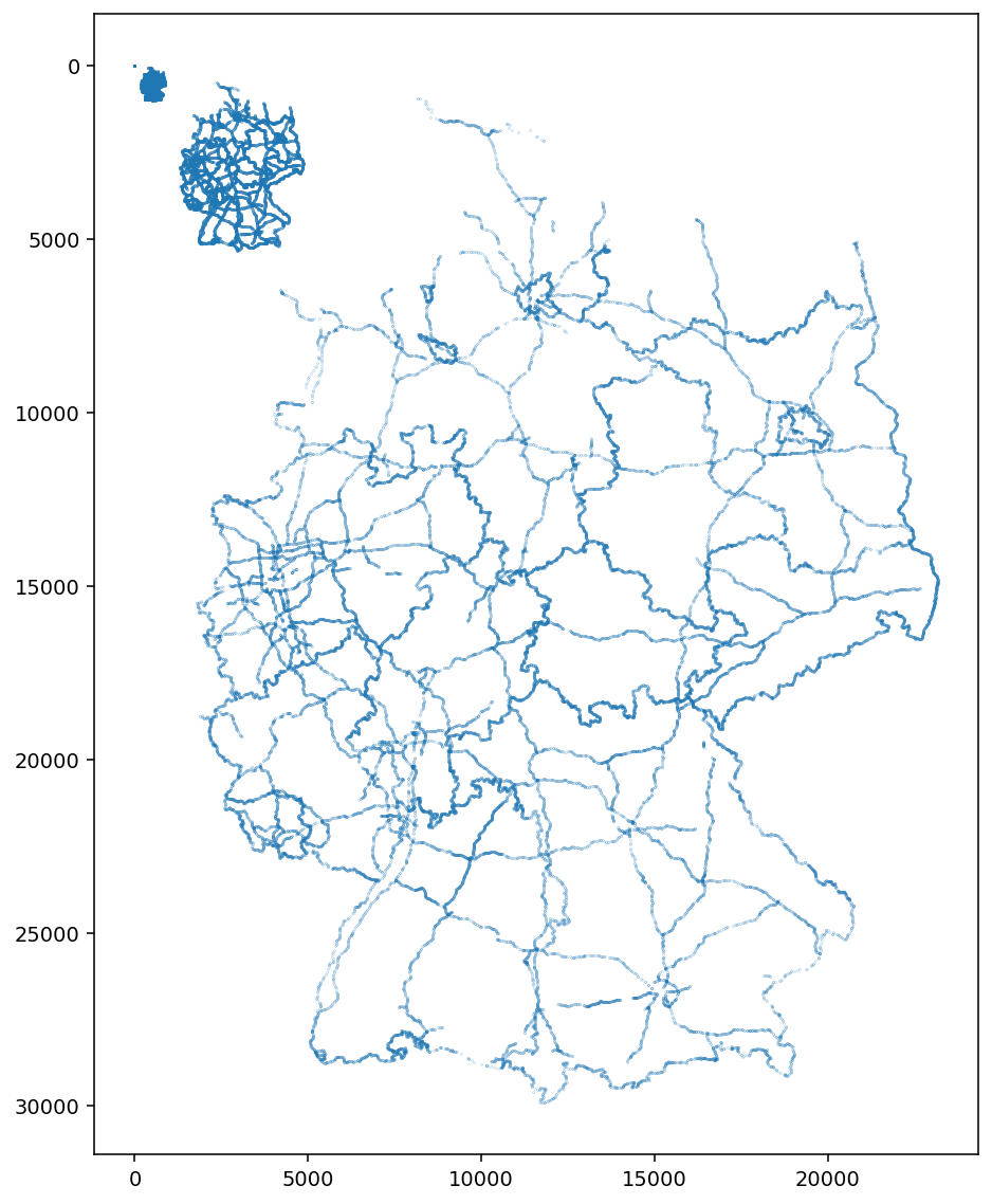
This finding is one reason for the title of this post: as before, we
have found coordinates of borders and
highways. Interestingly,
this time we found them in at least three different scales (or zoom
levels). I have not checked further, yet, how the different zoom
levels are ordered within that part and leave that as future work.
Anyways: I added a borders_and_highways1 part to
dsat.ksy and renamed the existing part to
borders_and_highways2.
Browsing through dsatnord.mp with the updated dsat.ksy using the
Kaitai Struct
Visualizer
(ksv) brought the next surprise. Having a look at the hex values after
the newly discovered part with the coordinates for the borders and
highways, I saw again the character sequence BM – the format
indicator for Windows bitmap
files. (This is
the second reason for the title of this post.) I thought: Nachtigall
ick hör dir
trapsen!
Now the power of Katai Struct comes into play again: I imported the
specification for BMP
files
and added a new element of type: bmp after the
borders_and_highways1 element. Parsing that caused no problems, so
the chance that I had found another BMP file was high. Thus, I
extracted it with dd (using the size information from the BMP
header as
before):
dd if=dsatnord.mp of=img.bmp bs=1 skip=10694797 count=975894
The result was a 570x570 colour aerial image of an industrial area
which appeared familiar to me. However, before I could solve that
mystery, I checked the hex values after the newly discovered part and
found another BM string. 😄
The data contains a 574x577 colour image, a zoomed-in version of the first image.
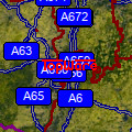
My immediate thought was that this probably shows a building from the company that produced D-Sat 1 and that it was maybe some kind of easter egg that is shown when one zooms into the corresponding location. So I checked the help pages of D-Sat 1 and among some other addresses found this one:

When I checked the address using Google Maps I basically saw an updated version of the aerial view from the 1990s I had found. Bingo!
Since Mannheim is in the south of Germany, the highest resolution
images for that area are located on the second CD-ROM (in the file
dsatsued.mp). So I started D-Sat 1 with that second CD-ROM and
quickly saw what I had seen before but forgotten:
Already at the lowest zoom level (fully zoomed out) the logo of the distributor (“TOPWARE”) placed at Mannheim is visible. A double click on the logo shows a 500x500 section of the first aerial image I have found in a separate window titled “Markerbild”. Another double click on that image shows a 500x500 section of the second aerial image. Looking at the contents of the CD-ROM I discovered why the images looked familiar to me:
> ls -l *.bmp
-r-------- 1 foo foo 251078 28. Jan 1997  mannh1.bmp
-r-------- 1 foo foo 251078 28. Jan 1997  mannh2.bmp
> file *.bmp
mannh1.bmp: PC bitmap, Windows 3.x format, 500 x 500 x 8, image size 250000, resolution 23621 x 23621 px/m, 256 important colors, cbSize 251078, bits offset 1078
mannh2.bmp: PC bitmap, Windows 3.x format, 500 x 500 x 8, image size 250000, resolution 23621 x 23621 px/m, 256 important colors, cbSize 251078, bits offset 1078
I had a look at these two files before when browsing the CD-ROM contents. They show the same aerial images as the embedded bitmaps.
I have not conclusively checked (yet) whether dsatsued.mp also
contains the two bitmaps, although I am pretty certain that they are
embedded, since a grep on dsatsued.mp for the last six bytes of
the first image (grep -obUaP "\x44\x4a\x40\x42\x00\x00"
../dsatsued.mp) yielded a result. However, given their exact 500x500
size it seems likely that the two files mannh1.bmp and mannh2.bmp
are shown instead of the embedded bitmaps.
It turned out that the first CD-ROM (for the north of Germany) also
contains those two files and clicking on the TOPWARE logo also works
on this CD-ROM. So it is likely that the two bitmaps with the same
content (but a slightly different size) from dsatnord.mp are not
used at all.
Having thought a bit more about this discovery I looked again at the
lower four fifths of the greyscale representation of the unknown2
part (first image in this post) and realised why it always looked so
suspicious to me: it basically shows a distorted greyscale version of
the two images. With the right number of columns – three times the
image width, since the three RGB values of one colour pixel result in
three greyscale pixels – and a correct start byte the aerial image
should be visible. So I did this:
dd if=dsatnord.mp of=aerial1.dat bs=1 skip=10694851 count=975840
./src/mp.py -c vis_bytes --width=1712 --out=aerial1.png aerial1.dat
# alternative: convert -size 1712x570 -depth 8 gray:aerial1.dat aerial1.png
And here’s the result:
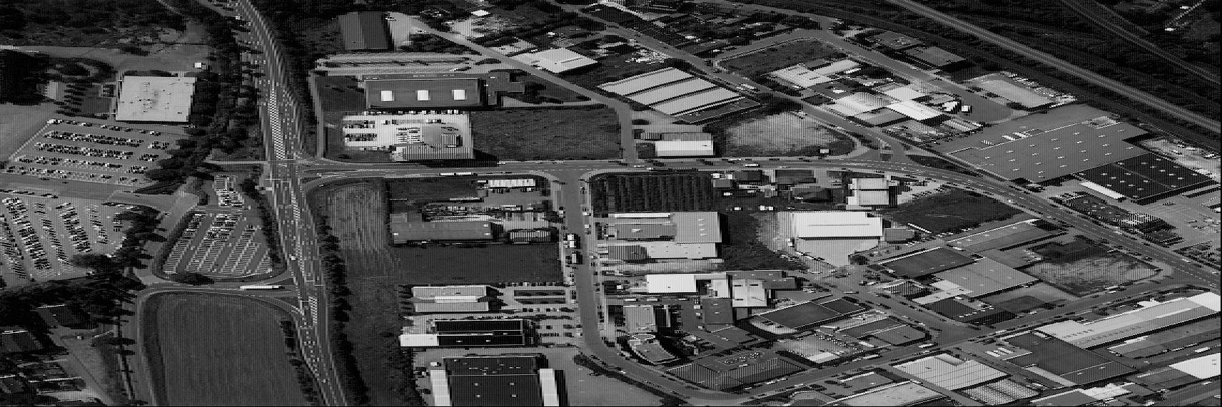
Exactly as I expected it. How satisfying.
And then I also realised: that’s it! There’s nothing more to discover
in dsatnord.mp. Just some null bytes and some boring strings and
maybe a few bytes at the end (which are likely also quite boring). So
my “endeavour to reverse-engineer the file format of D-Sat 1” was kind
of successful. But does it also end here? Well, no! There are still
two quests to solve: the mystery of the coordinates (or better: their
projections) and the decoding of the image format for the
tiles.
Thus, in one of my next posts I will provide an overview on what we
know and what we do not know so far about the content and structure of
dsatnord.mp. Furthermore, I have already planned three more posts
which will cover the following topics:
- the different coordinate systems I have found and my approach to make sense of them (the impatient can have a look at Coordinates.ipynb)
- the raster image format used for the tiles and information I could find about it (the impatient can have a look at Cod.ipynb)
- what I discovered when I started the Lightning Strike Image Compressor V2.5 (the impatient can download it here and then test it)
Happy reverse-engineering to everybody!